Energy, Environment, Geoinformatics
Translating Submerged and Buried Cultural Heritage from Shallow Water to Digital environment with Geoinformatics -ClepsYdra
An important research and innovation program is entering the path of implementation coordinated by the Laboratory of Geophysical Satellite Remote Sensing and Archaeoenvironment (GeoSat ReSeArch Lab) of the Institute for Mediterranean Studies (IMS), Foundation for Research and Technology-Hellas (FORTH). The core of the project lies on the establishment of new methods and protocols for the documentation and valorization of Cultural Heritage in shallow water contexts. Archaeological areas under a layer of water are endangered and threatened by aggressive agents like water salinity, waves and water motion, algae, sand movements, coastal erosion etc. At the same time, submerged remains are not easily exposed to the research and local community, which may result in natural protection from looting/vandalism.
Thus ClepsYdra is a research program that maximizes the accessibility to information regarding the current state of now submerged sites by minimizing the gap of available protocols and procedures for shallow-water CH investigations. Furthermore, ClepsYdra focuses on developing ways to explore and promote these under-studied submerged contexts, improve community awareness and involvement in protection practices, digital curation and informed tourism. To achieve these goals, ClepsYdra joins the efforts of two international research institutes from Greece (IMS-FORTH) and Italy (ISPC-CNR) in close collaboration with the Greek Ephorate of Underwater Antiquities from the Greek Ministry of Culture and Sport. The synergy of these entities aims at boosting the development in respective fields and promote future collaboration on a larger scale.
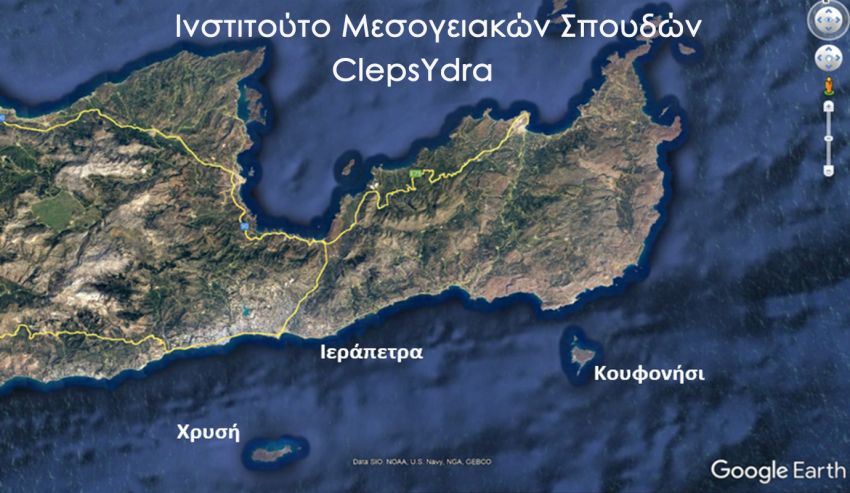
The case-studies for the implementation of the actions of the project are situated in Eastern Crete (Koufonisi, Chrisi, Ierapetra), where the geomorphological processes shaped large-scale changes on the coast. Numerous locations testify here this sensible landscape modification, so that past coastal settlements/infrastructures are now covered with water and/or sand layers and are potentially excluded by the scientific community’s discourse on past coastal exploitation. ClepsYdra will side the archaeological research with state-of-the-art methodologies and innovative technological integrated framework for the documentation and promotion of CH, adapting equipment and practices to the shallow underwater context.
The contribution to the documentation of current state of CH will pass through: a) aerial/satellite remote sensing –specifically targeted to historical reconstruction of coastal zone and seabed, b) digital photogrammetry –with customization of remotely controlled floating device and specific protocols to account for the camera/lens distortion in water medium, c) geophysical mapping –with adaptation of sensors and protocols for the wet environment, d) risk assessment –integration of collected spatial information for the estimation of risks for CH, e) Virtual/Augmented Reality platform –fed with the above for the promotion of submerged CH in unprecedented ways.
The scientific supervisor of the project Dr. Nikos Papadopoulos, Research Director in FORTH states that: “Time is definitely the most essential and distinctive connotation of cultural heritage which, in combination with space and human interventions, are responsible for the conservation of archaeological remains. Its present and future survival is often threatened by various factors, mostly driven by natural phenomena. This is particularly evident when the “space” in which these artifacts are hosted today is hostile, thus rendering the documentation-process a complex and expensive (if not impossible) task. This is the case of archaeological sites close to the modern coasts which were once in dry land and are now submerged as a result of the sea-level change across time.”
The program “Translating Submerged and Buried Cultural Heritage from Shallow Water to Digital environment with Geoinformatics- ClepsYdra” is funded by the Hellenic Foundation for Research and Innovation (H.F.R.I) under the framework of the 2nd Call for H.F.R.I. Research Projects to support Faculty Members and Researchers and will have a duration of two years